Day 12 – On to the bottom of the top of the world!!

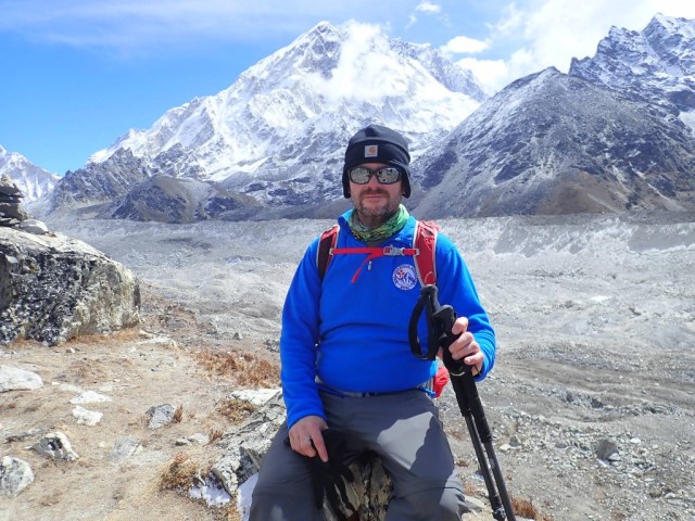
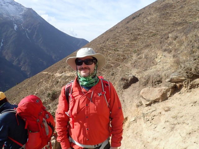
oke up after a decent 6.5 or so hours of sleep. I was surprised that I got a decent night’s rest; I didn’t sleep s wink before Lukla.

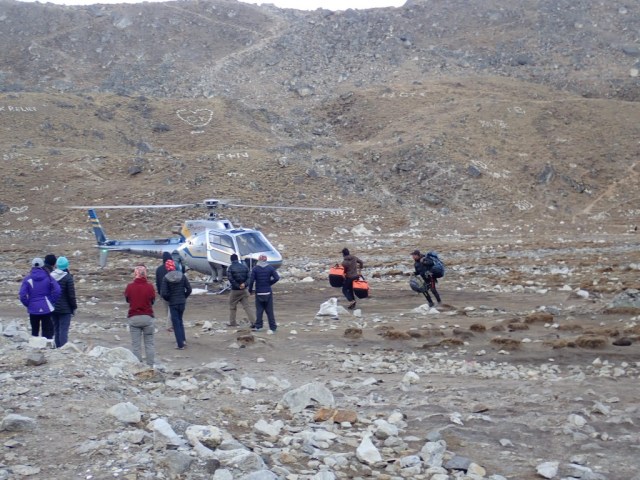
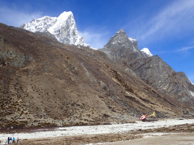
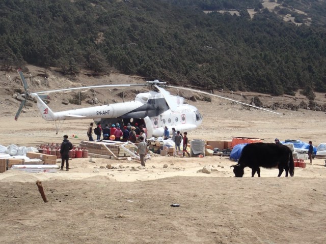
I didn’t have much time to wander around camp because I had to get all my gear together and ready for the trip to EBC. We heard a helicopter come in fairly early; it was evacuating someone from another team that had severe altitude sickness. I had seen this person the previous day being cleaned up after he vomited all over himself. One of our teammates had a room next to his and heard the same going on all night. He should have been moved to a lower altitude the previous day; I hope he is ok. Little did I know it was foreshadowing for our day.

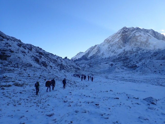
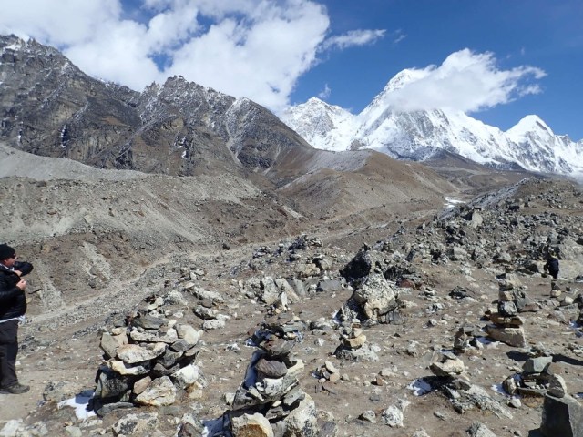
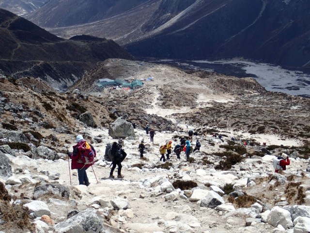
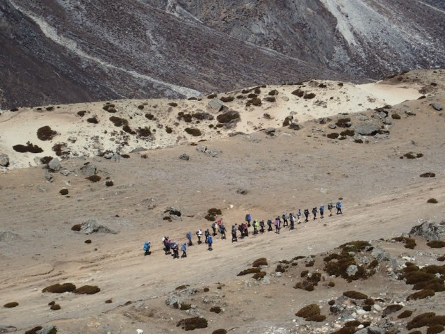
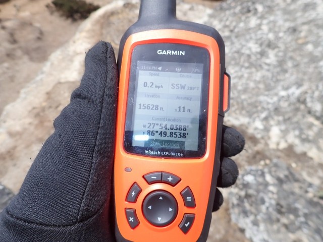
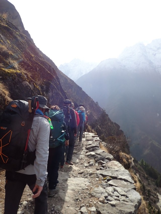
We started out of Lobuche, it was not a hard climb up, but decently rocky terrain. We had been on the trail maybe an hour, and stopped for a breather. I didn’t realize immediately that one of our teammates was in trouble. They were having issues breathing, and got to where they couldn’t walk. That pretty much locked in a medical evacuation via helicopter. The Adventure Consultants team did a great job of dealing with the crisis and organizing the response. One of our sherpas (Kami) ran up the trail to catch up with our porters to get the oxygen bottle and the Gamow bag (a Gamow bag is a big bag you put someone in and pump up pressure in order to simulate  lower altitude). Amazing how fast he could run when I can’t even walk fast at this altitude. Our teammate is now back in Kathmandu and doing fine. A quick response was crucial. What really captures my attention is how quickly it set on; we had only climed 200 ft or so of altitude when this happened, and they had seemed fine before.

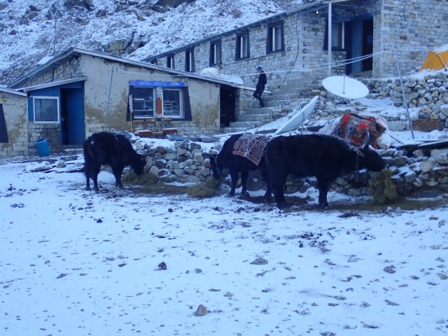
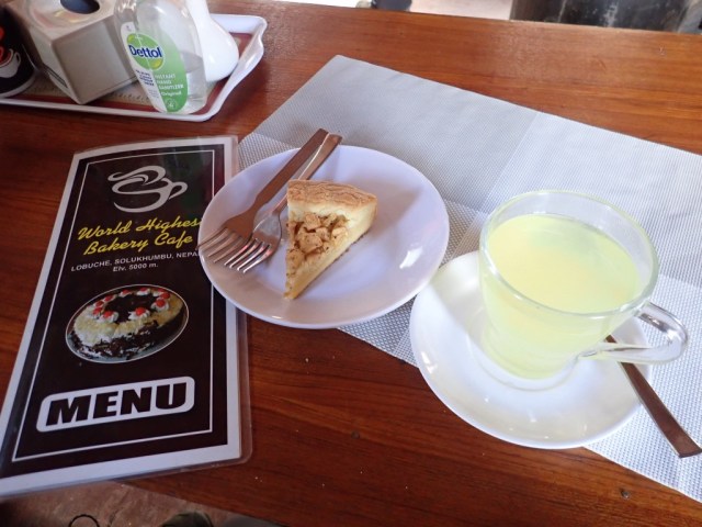
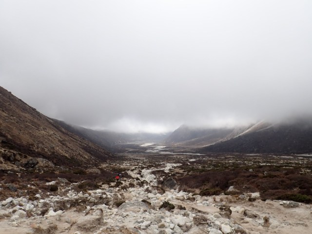
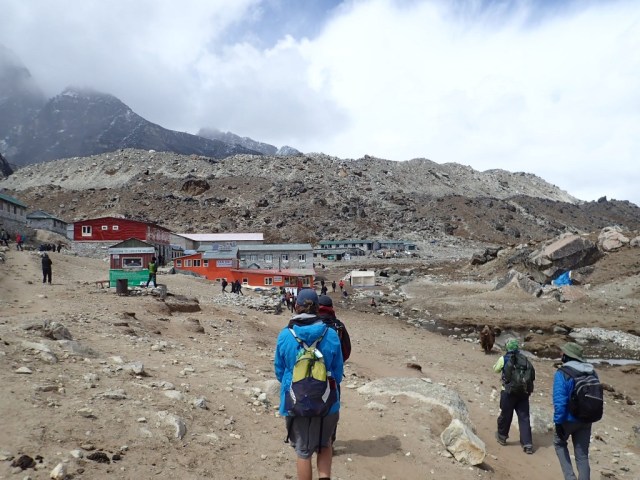
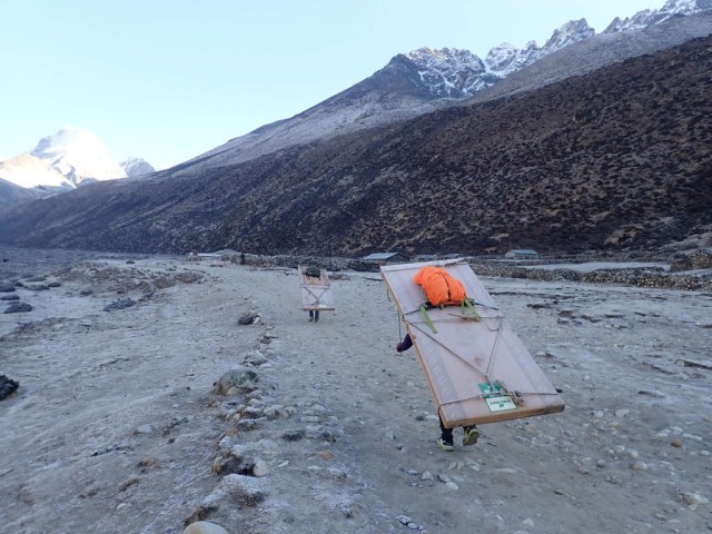
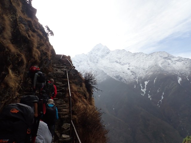
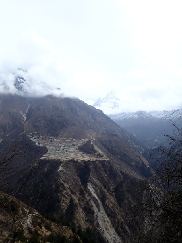
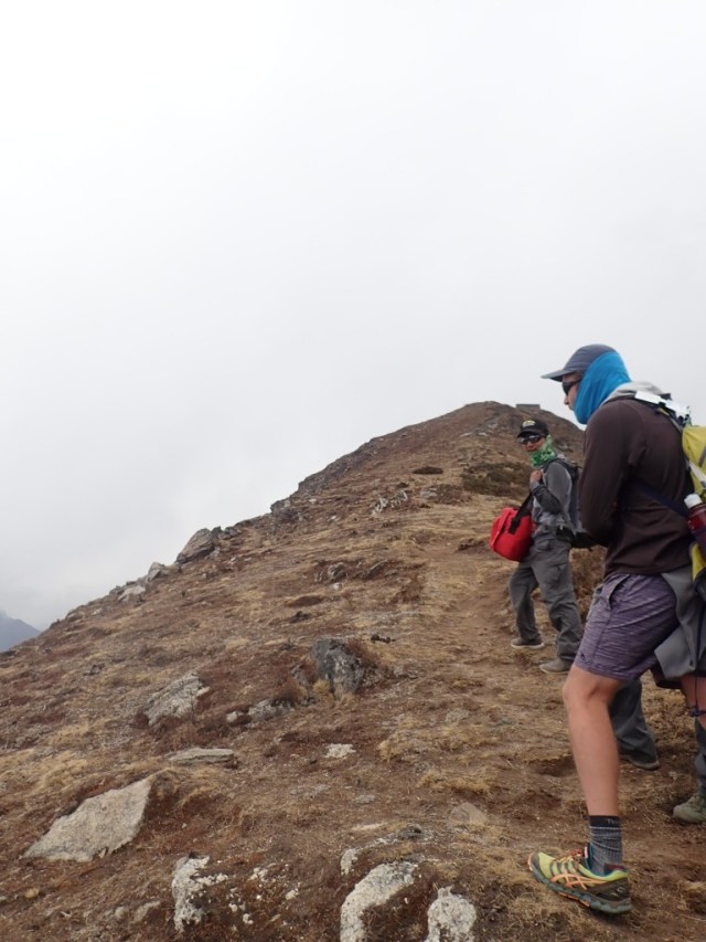
Ultimately, we we told to go on ahead while our guide and other staff stayed behind to see to the evacuation. We ultimately got to Gorak Shep. The terrain has gotten a lot more difficult in terms of rockiness and narrow ledges. There were a few climbs, but no climbs as steep as what we had done previously. About 2 hours later, we arrived at Gorak Shep and had lunch. As we get further up the valley, the quality of the food continues to decline, but edible. As we were eating lunch it began to snow.

kpOI001208-768x1024
Example of our terrain
kpOI001198-1024x768
Some more of the terrain we negotiated
kpOI001241-1024x768
Our group working our way through the snow. Yes, second from back we have a kiwi wearing shorts!
kpOI001205-768x1024
Me with one of our first views of Everest on the way. It is the darker mountain in the middle behind Nuptse on the right front. Everest is very shy, Nuptse loves being photographed
kpOI001239-768x1024
Hard to see, but that is base camp in the distance on the left. Finally!!

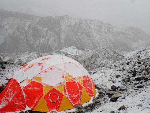
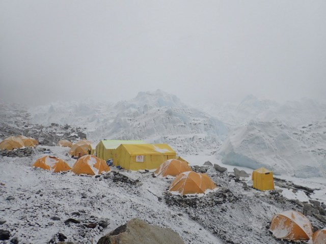
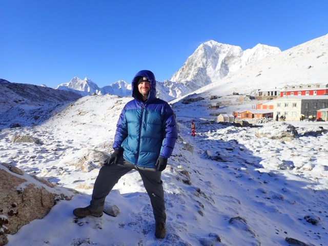
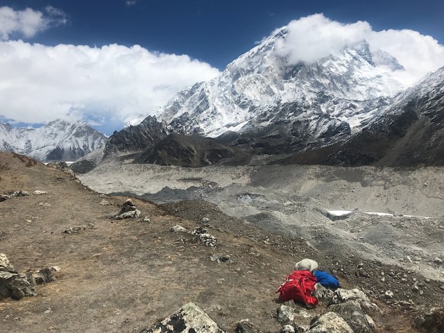
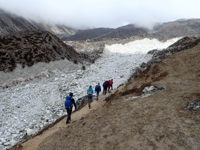
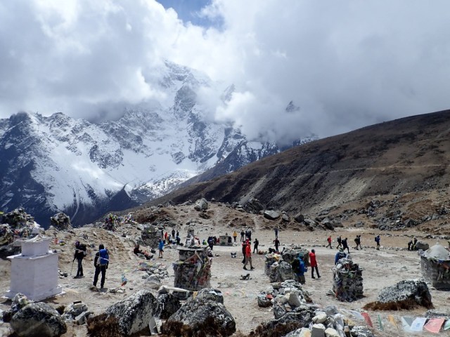
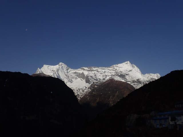
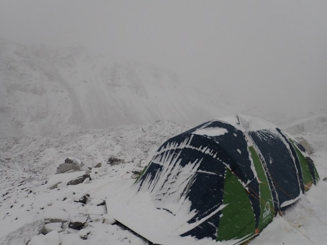
After lunch, we set out for base camp in the snow. This was the roughest terrain yet; like someone took a barrel of rocks and just dumped them out in some places. The snow meant you just had to take that much more caution on the path. After a little more than an hour, we got our first view of base camp, that energized the team a bit. I think we rolled into base camp about 4:00 PM. Some of the Adventure Consultants staff greeted us at an iconic entrance rock.

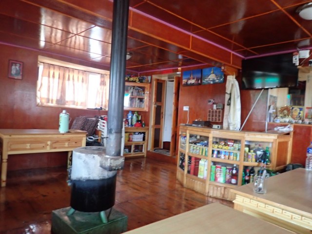
Getting to the AC base camp, we were happy for the hot drinks and snacks waiting for us. The facilities were excellent; we had a nice comfortable common area for us to come to and relax. We had an excellent supper, the chefs at camp were quite good. We had large tents with little padded mattresses, with two separate sleeping rooms. We fit 4 people in one tent, and 5 in the other, so it was a little more crowded than normal, but very doable.

OI001190-1024x768
Our lodgings for the night

I went to sleep hoping the trend of clear weather for mornings would continue; we really didn’t get to see much on the way in due to the snow.

Day 11 – Resting in Lobuche

Today was a rest day, a “real” rest day; no strenuous acclimatization hikes. I woke up and once again saw blue sky, and upon closer inspection saw that we also had received a decent layer of snow. This was the perfect excuse for me to don my heavyweight thermals and go do some exploring.

What a gorgeous morning! I watched as the sun slowly painted the surrounding mountains as it climbed up from the horizon. As always, the mornings are calm; there were few people out and about before 0700. A little bit later, we had a few groups head out further up the valley towards Everest.

OI001054-1024x768

OI001068-1024x768
Morning sun on mountains
OI001075-1024x768
Yaks getting breakfast
OI001102-1024x768
I finally got to put my heavyweight jacket to good use
OI001082-1024x768
Morning trekkers/climbers headed off to Everest

Back into the warmth for breakfast. The food is still good, but a notch below what we have gotten in the past ; not surprising given the nature of this lodging camp. After our slow paced breakfast, we gathered outside for a very short hike up the moraine outside the village. The moraine is the rocky wall that makes up the side of the glacier, separating it from the rest of the valley.

It was an easy hike, but oh the views. We were surrounded by mountains; you could see Nuptse, Pumori, and Lobuche peaks. I also saw my first good ice fall and the Rock bed carved out ages ago by the Khumbu Glacier.

OI001124-768x1024
Ice fall
OI001152-1024x768
Me with Nuptse in the background
OI001121-1024x768
Sherpa Kami and Flat Stanley

There were a ton of cairns (stone memorials) on the ridge. I found a nice quiet spot to lay out on the hillside and soak in the view in solitude and soak up some sun. This is quite possibly one of the most beautiful natural sights I’ve ever experienced; I’m afraid photos will not do full justice. All good things must come to an end; our guide rounded us up and back to the lodge we went.

OI001130-1024x768
Cairns with Pumori in background (peak on left)
AA4B1AD2-4872-427F-ACD9-8B47CDD00723_1523429681.8496
Me resting with s great view of clouds an Nuptse. I could have stayed here all day!

I had a cheese (nak cheese) pizza for lunch, very good. Following lunch, I was very happy to pay $6.00 for a hot shower (no cold showers yet). After that, I sat in my room and made notes for the day (I was having my tablet and power bank charged at a cost of $10.00, so I had to take my notes. “old school”).

My roommate and I were also trying to keep each other awake (guide’s orders), so we finally got out and walked around the camp. We stopped in at the world’s highest bakery (4910 meters); I had a cup of hot lemon and a slice of apple pie for the sum of $7.50. prices have definitely increased as we have worked our way up the valley; a bottle of water now costs $3.30 where it cost $1.00 in the first stages of our hike. I wanted coffee with the pie, but we need to stay of caffeine at altitude; I haven’t had coffee for several days; this is an expensive way to detox! With all the food we have been getting, I am beginning to think this excursion should be called the “Everest food tour”.

OI001170-1024x768
“High” Apple Pie

On our way back to the lodge, a helicopter came in, dropping supplies and picking up gear and people. They ended up kicking one person off the chopper, I’m assuming due to weight. In total, the chopper was on the ground for around a minute. Observing some of the supplies being hauled to the lodge, we discovered a large portion were eggs, 2 of which I’d be eating for supper!

OI001174-1024x768
Chopper dropping off/picking up

Not much else happened; we met for supper, discussed the coming day, and headed off to bed. My O2 stats are still running a little low at this higher altitude; I’m at 84% for 02 saturation, but at least my pulse has dropped back down since the morning. Other than the headache my first evening in Lobuche, I’ve had no altitude symptoms other than the expected shortness of breath while being active. Others in the group are on diamox to help with altitude.

Everest tomorrow!!!

Day 10 – Pheriche to Lobuche

We met for breakfast at 0730 and discussed the plan of attack for the day. We were to hike to the village of Lobuche and gain 2300 feet in altitude. Every step up is a new altitude record for me.

We bid farewell to the summit team; they are taking a higher path to EBC to give them the extra acclimatization they need. The summit team are a really good group of people. I was concerned we might be looked down on because we were only trekking to base camp and not mountaineers. However, nothing could be further from the truth, they accepted us into the fold. There are a couple of real characters in that group.

OI001004-1024x768
Looking back at Pheriche as we leave it behind us

Leaving Pheriche behind us, we started a new class of rock terrain. The uphill climb was not as bad as some of our previous days, but now the altitude is working against us. The key is to go slow; getting yourself out of breath does nothing but hurt you at this altitude.

OI001009-1024x768
Rock fields on the way up

We stopped in Duglha for hot tea and soup, and crossed paths with Peter Hillary again; he is involved with a Canadian group attempting Everest this year.

OI001026-1024x768
Looking back on Duglha as we press on

We continued upwards and are greeted with fields of rock left from the Khumbu Glacier. We also passed through memorials for those lost on Everest, and stopped for a small break.

OI001034-1024x768
Memorial area
OI001032-768x1024
Memorial for American Scott Fisher, Mountain Madness owner/guide lost in the 1996 Everest tragedy (covered in the movie “Everest”)
OI001039-768x1024
Our team sirdar Kancha with Flat Stanley, Lobuche mountain base camp in background (yellow tents)

We continued to climb, but it was much more gradual at the point. We passed by base camp for Lobuche mountain and entered the village of Lobuche about a mile later.

OI001044-1024x768
Approaching Lobuche
OI001047-768x1024
Our porters beating us to the lodge. These guys are amazing. Teenagers carrying around 60 pounds on their backs while we carry 10-15. We could not make the trip at this pace without them

Lobuche is definitely different from our previous stops. Due to its close proximity to Everest, it is a climbing outpost. Think of a mining town. At least it does have internet (at $6 per 200 MB), so I can get today’s post on the blog.  The lodges here are rudimentary compared to what we have seen thus far, and you see tents around the village for those who could not get a room in one of the lodges. Our guide also cautioned us against eating meat here (a first for this trip). Unfortunately some of our porters/sherpa staff appear to be in tents too, which does make me feel a bit guilty. A lot of our porters went back to Pheriche for lodging. In “real” villages, someone will take them in and put them up for the night.

We had a late lunch, and then were assigned our rooms. I am feeling the impact of altitude for the first time now at 16010 feet. I have a headache, have a bit reduced cognitive capacity and my 02 saturation is is at 83% with a a pulse rate of 73. While O2 stats like that would get me  a hospital visit in my normal environment, this is not unusual at altitude. These are all normal things to be expected with minor altitude sickness. Hopefully a nights sleep will help; we are on orders from our guide to not sleep before dinner (1 hour to go as I type this).

The main thing is….. 2 DAYS TILL EVEREST!!!

Off to Lobuche

We have breakfast at 0730 this morning and then will head off for Lobuche. I don’t know if I can get internet, so this may be the last post for a few days. I’ll know by tonight. My GPS feed should remain active.

Day 9 – Hanging in Pheriche

Got decent sleep after waking up in the middle of the night; a bit over 6 hours. The temperature of my lodge room was cold (37 degrees F)  – I was happy to have my warm sleeping bag. When I looked outside my bedroom window, I was excited to see blue sky. So I got out and walked around the village around 0600. I enjoyed the silence of the morning; locals were milling about, but all the trekkers were either snug in their sleeping bags or sipping a warm drink in the lodge dining rooms. The views were absolutely amazing!

OI000854-1024x768

OI000892-1024x768
We had a rotary wing alarm clock
OI000878-1024x768
Porters headed up valley with wooden panels before 0700
OI000884-1024x768
Our view for breakfast

We met for breakfast at 0800, and headed out for our acclimatization hike. We were going to ascend a local hill to gain some more altitude to help with our acclimatization process. It was a lot of climbing (duh). The further up we went, the greater the views became.

OI000922-768x1024

OI000937-1024x768.jpg
We were on a popular trail system for our acclimatization hike
OI000951-1024x768
Dingboche, where we will divert on the way down
OI000966-768x1024
Nuri, one of our sherpas, with Flat Stanley
OI000940-1024x768
Lhotse in the background

OI000974-768x1024

We got awesome views of Lhotse and Ama Dablam. We hit our altitude goal of around 15,000 feet. Many of us were still feeling good, so we pushed further up to 15628. This will make our coming days easier as we continue to ascend to base camp.

OI000985-1024x768
Flat Stanley at the Apex of our hike with his foot on Ama Dablam
OI000978-768x1024
Me at Apex of hike with Ama Dablam I background
OI000987-1024x768
Highest I’ve been ever, and more to come

We then descended to the nearby village of Dingboche and stopped in at a bakery (same one that made the birthday cake from last night). I had a slice of apple pie me (tasty!) and also bought a slice of banana bread to hike back to the lodge for later. We then hiked back over the ridge to Pheriche.

OI000994-1024x768
Stupa entering Dingboche
OI000995-1024x768
Apple pie and Banana Bread at Dingboche bakery

Clouds had been slowly rolling in all day; clear in the morning and cloudy in afternoon is pretty much the norm (or so I’m told).

We had a late lunch (1430) and slipped in a few minutes late to the altitude sickness talk. Altitude sickness is no joke, but as long as you don’t ignore the warnings you should be fine. Our team has acclimatized very well.

OI000842-1024x768
Staffed by volunteers and funded by donations, the Himalayan Rescue Association saves lives. It is also the only medical treatment for this village and its neighbors.

After the talk, I paid for the luxury of a hot shower; it may be my last such chance for many days. I had a light supper due to the late lunch and pie; Chicken Noodle Soup. Our guide squared the plans for the day away, and then it was time for bed. I’m sleeping with my electronic devices in the foot box of my sleeping bag now to try and preserve their batteries.

Before sleep, I checked my O2 stats: 93-94 %; time to move on up the mountain valley!

Day 8 – Pengboche to Pheriche

After 7 hours of sleep (best yet), I woke up to snow on the ground. Nothing heavy, but a good dusting. The temperature in our lodge room was 40 degree F.

OI000666-1024x768
Red building on the right is the gompa where the blessing ceremony was held.

OI000679-1024x768

O2 levels hanging around 90-91%, so that seems good to me. The expedition Dr. had said the numbers don’t matter until you start to feel bad, but to me it is still a good metric to watch my progression (or regression) as altitude increases.

We started off the day with breakfast (apple pancake for me). I am seriously beginning to wonder if I am going to gain weight on this trip. After breakfast, we went to the local gompa (monastery) and observed a blessing ceremony where the lama blessed the climbing team; the climbers will have another ceremony at base camp. These ceremonies are traditional for the climbers.

OI000683-1024x768

OI000689-1024x768

After this, we got our gear together and started the day’s trek to Pheriche. This was going to be a shooter hike (3-4 hours), so we did not have to get in as much of a hurry.

We basically followed the river deeper into the valley. There were are lot more trekkers on the trail today than the previous day, not sure what the difference was.

OI000807-768x1024
Traffic jam heading up the valley

Stopped for a late morning snack and “hot lemon” about halfway at a village. I had Tibetan bread here for the first time. It was basically a big fried bread pancake. If you added powdered sugar, it would be dang near a funnel cake.

OI000768-768x1024
Me at our lunch stop. Headed into those mountains!

It was clear we were on the main path; helicopters buzzed by us going back and forth all afternoon long. I believe most of them were sightseeing tours. I believe we had learned earlier in the journey such a flight would run in the neighborhood of $4500 per person. They do in less than an hour what it will take us 14 days to do. But there is no way those on such a sightseeing flight experience anything near what we will earn on our foot journey.

Onwards we went. It was not far past here we lost any hope of cellular coverage. However, it was a happy trade for our first view of Everest. The path from this point was fairly easy in comparison to some of our previous day’s. Some minor elevation changes, but not very many steep climbs or narrow paths.

OI000799-768x1024

Not far from Pheriche, we stopped to rest on a gentle hill in the sun. It was one of the most pleasant moments of the trip; I could have sat there for hours happily.

OI000813-1024x768
Team crossing river over to Pheriche

Got to the lodge and had a late lunch/afternoon snack. This is by far the nicest lodge we have stayed in, which is surprising seeing how deep we are in the mountains. My 02 levels now sitting around 88-89%. We’ll see what they are in the morning.

After walking around the village a bit, I returned back to the lodge, entered my previous day’s blogs and walked over to the restaurant. I have to say, I never thought I’d be eating dinner at 14,000+ feet with Guns and Roses, Aerosmith, and Bryan Adams playing in the background. I equally wouldn’t have thought I would have been at a birthday party in the same environment; it was one of our teammate’s birthday, so we had a signed card for her. Our guide had also arranged to have a cake made at a bakery in The nearby village of Dingboche – they even delivered. Cake was excellent, especially considering where we were.

After dinner and cake, there was only one thing left to do – get in my sleeping bag and catch some Z’s.

Day 7 Khumjung to Pangboche

We had an early breakfast (0630) and we’re on the trail by (0730). We needed the earlier start because this was going to be one of longer day; we were looking at 6 to 8 hours hiking on the trail. My lock on the duffel the Porter’s carried ahead of me malfunctioned; I just had to hope a zip-tie would keep honest people honest.

OI000603-1024x768
It was clear as we left Khumjung

It was very cool when we left the lodge, so we had our jackets on. Of course, we weren’t 20 minutes down the trail before we were overheating and pulling our jackets off.

OI000614-768x1024
Early on in the day’s trek

OI000619-1024x768

The first 1/3 was climbing up, we stopped for tea in Mong at roughly 12,980 feet. We caught up to the summit team here, the had passed us on the trail. We were starting to get good views of Ama Dablam ans Lhotse through the clouds.

OI000637-1024x768
No false advertising here

We then started our descent to a river crossing near Phortse, giving up much of our hard fought elevation. The way down was difficult; lots of rock steps with loose dirt and gravel. I was very glad to have my trekking poles; while some in our group were not using them, that wasn’t for me. The poles saved me twice, but my luck finally gave out; I slipped, catching myself on a rock with my forearm. I count myself lucky that I came out of that with just a little soreness.

OI000632-1024x768

OI000641-768x1024
Upper Phortse, where we are headed for lunch

We crossed the river near Phortse and then started our ascent to Phortse for lunch. Getting to the village was just the start. We had to hike 15 minutes or more through the village to get to the restaurant where we would eat. As we travel up the Khumbu Valley prices start going up. A bottle of water that cost me $1 in Namche is now running $2, and we still have a good way to go.

After lunch, we headed off, climbing up and leaving Phortse below us. We were basically on mountain edge paths the rest of the way. We had donned our waterproof jackets since it looked like we were going to be walking through clouds. It was not long before were hiking through snow for the first time!  With little more than 1/3 of the way left, the faster hikers in our group split off and went ahead. I stayed with the slower group. While I could do a decent job of keeping up with the faster folks, I really didn’t see the need to; it was much more comfortable to take the slower pace. Along the way, we came across Yak graving on the hill; it still amazes me how easily these animals navigate the terrain. The yaks actually boxed us in for a bit on the trail; I wondered if we were getting set up for a Yak ambush!

Not long after the yaks, we where upon Pangboche, and it was a welcome site. I was definitely ready for rest and happy to pay $4 for a hot shower. Spent the time talking to more group members in the evening; everyone has thier own story to tell. It is also a small world; one of the US climbers has offices halfway along my daily commute to work.

OI000663-1024x768
Earrings on a Yak; I’ve seen it all.

My bag made it unopened to our lodge, and the AC team found me another lock for 170 rupees (about $1.70). One less thing to worry about; thanks all.

We had dinner, replenished our water bottles, and off to a well earned sleep. This was a tough day, but clearly within the realm of the doable. I am so glad I made the time to train for this.

Day 6 – Khunde Peak and Khumjung

We met for a late breakfast (0800), and then started climbing out of Namche. Down in Namche, you could only see snow covered peaks in one direction, with one more peaking out over closer, lower peaks. But as we climbed up, the scenery really opened up around us.

OLYMPUS DIGITAL CAMERA
I mailed a few postcards, let’s see if they beat me home!

OLYMPUS DIGITAL CAMERA

OI000492-1024x768

On the way to Khunde peak (13,779 ft), we stopped at Syangboche. We happened to luck into a few helicopter landings at the short dirt airstrip. We saw both supply and tourist helicopters. It seemed like half the village came out to help unload.

OI000504-1024x768

OI000509-1024x768

After that, we continued the difficult climb up to Khunde peak. The point of this exercise was to work our bodies at a higher altitude and then to descend to sleep. This would help with our acclimatization. While there were fewer rocks on the upper half of the path, the path was narrow and quite honestly, a bit on the concerning side; you really had to pay attention to what you were doing. Trekking poles made a huge difference however, it gave me 4 wheel drive! It also amazed me to see animals grazing on the side of the mountain.

OI000540-768x1024
On the way to the top of Khunde Peak

As we went up, the environment changed. We hit the tree line and it turned cold on us; insulated jackets and gloves came out. We finally reached the top, and the view was spectacular. It was nice to get a rest and eat a little snack.

OI000553-1024x768
Made it to the top

OI000563-1024x768

OI000559-1024x768
Flat Stanley with Khunde and Khumjung in the background

We then started down to Khunde, where we were planning on having lunch. I won’t lie that I was ready for some downhill after ascending roughly 2500 feet. It didn’t take long to get to Khunde. The food here still surpasses my expectations. For around $4.50, I got a huge plate of potatoes covered by cheese. The lodges and restaurants on the trail also continue to exceed my expectations. Sitting in the restaurant, we got our first snow of the trip. It was clear in Khunde we were finally leaving a bit of the commercialization/tourist spots we had seen in Lukla and Namche behind.

OI000573-768x1024
Pathway in Khunde
OI000575-1024x768
Our lunch stop in Khunde

By time we were done eating, it had turned to rain. It was only a short jaunt over to Khumjung, where we were staying for the night. We dropped our stuff off in our rooms, and headed out to visit the Samten Choling Monastery in town. On the way, one of our group sidetracked us over to the Hillary school in town, and it was worth it.

Got to the monastery and paid our entrance fee. It was clear this was the monastery from a distance as it was the most ornate building in town. They also have a Yeti skull at the monastery (wink wink).

OI000596-768x1024

Walking through Khunde, the devastation from the 2015 earthquake is still evident. Kami (one of our sherpas) lost his home in the quake; he has a new structure, but estimates 2 years until it will be done. Even humble enclosures are super expensive to build as any supplies that can’t be sourced locally must be brought in by helicopter.

Got a nap before supper. Then ate and settled in for the night. My O2 is at 89% with the new altitude; we’ll see what it does overnight.

Another great day. Each day I’ve seen more beautiful that the day before!